Subtitle
Title
Title
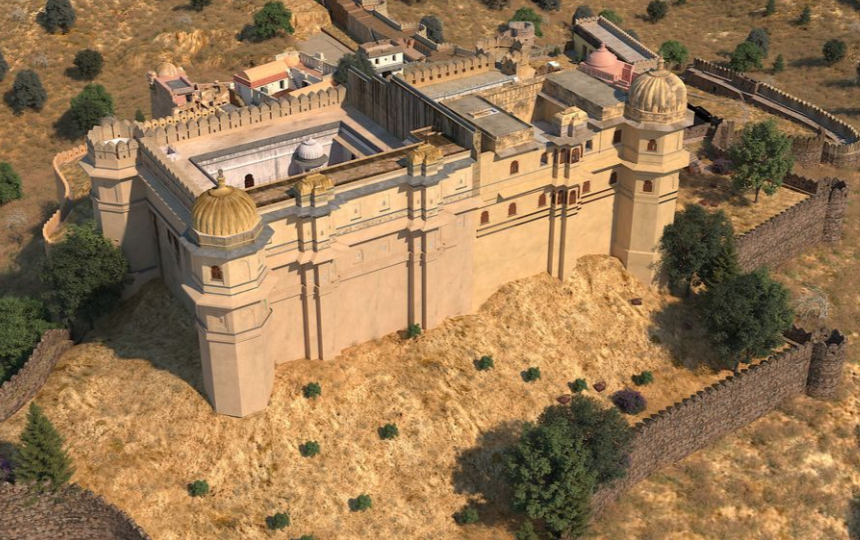
Kumbhalgarh Fort Rajsamand
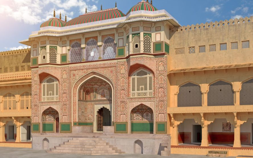
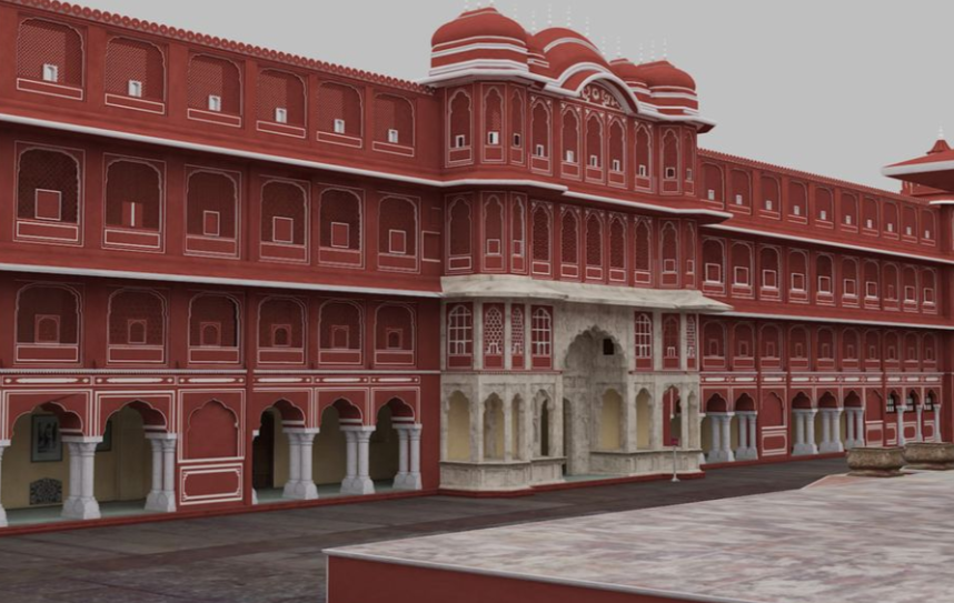
About the Project
Preparation of GEO-Referenced As-Built textured 3D models of the forts from 3D
LiDAR Scan data generated from the scanning activity. Based on the GIS information of
respective site, these 3D models shall be prepared to the expected levels of details that also
include terrain, transportation network, buildings with exterior, nearby vegetation; water bodies; such as street lights, park benches etc.
The 3D models shall be georeferenced to reflect exact geo-location, elevation and terrain on the earth surface.
Shayona had provided Scan to BIM, Heritage Modelling services to the Department as outlined below:
- GIS source Data Assessment
- Preparation of 3D Models
- Development of Videos Walkthroughs & Flythrough
- Virtual Reality Development
- Training for Validation of Data
- Operation & Maintenance
SHARE