
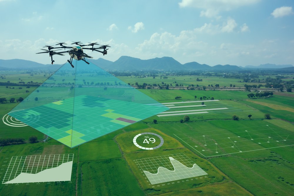
Drone/UAV Survey
- 3D LiDAR Scanning
- Drone/UAV Survey
- Mobile Mapping
- Orthophotos
- Geographic Information System (GIS) Mapping
- Ground Penetrating Radar (GPR)
- Non-Destructive Testing (NDT)
- LiDAR Data Processing
- 3D CAD Modelling
- 3D BIM Modelling
- CAD TO BIM
- SCAN TO BIM
- As-built Modelling
- 3D MESH Model
- Plant Modeling
- Smart City Modeling
- Digital Twin Modeling Services
- Reverse Engineering
- Infrastructure Assessment
- Stockpile Volume Calculation
- Heritage Conservation
- MR/XR Experiences
- Virtual Reality (VR) & Augmented Reality (AR)
- Virtual Events with 360 Degree Coverage
- Project Based Training
Drone LiDAR Survey Services in India | UAV Aerial Mapping & Terrain Surveys — Shayona Tech
When the Ground Survey Can't Keep Up, the Sky Takes Over
Some projects are too large for a ground crew with GPS and total stations. Some sites are too dangerous to put field teams on. Some timelines are too tight for a survey approach that takes weeks to complete a single corridor.
That’s exactly where drone LiDAR survey services change the equation. A UAV-mounted LiDAR sensor, flown systematically over a site, captures millions of precise data points per second building an extraordinarily dense three-dimensional picture of terrain, vegetation, infrastructure, and built assets. What would take a ground survey team days or weeks, a drone LiDAR mission can cover in hours. What a ground survey can’t reach safely, a UAV can map without putting anyone at risk.
At Shayona Tech, we operate as a professional drone survey company in India with full in-house capability across mission planning, data capture, point cloud processing, and final deliverable production. We work with infrastructure developers, engineering consultants, government agencies, mining operations, utility companies, and environmental teams across India providing aerial survey data that projects can actually be designed and built from.
What Is Drone LiDAR Surveying?
LiDAR (Light Detection and Ranging) is a remote sensing technology that measures distance by firing laser pulses and precisely timing how long each pulse takes to return. When a LiDAR sensor is mounted on a UAV and flown over terrain or infrastructure, it captures the three-dimensional geometry of everything below terrain surface, buildings, trees, power lines, road surfaces with centimeter-level accuracy.
Unlike photogrammetry (which uses overlapping images and struggles under vegetation canopy), LiDAR mapping uses multiple return technology: a single laser pulse can return from the top of a tree canopy and then again from the ground below it. This means drone LiDAR can produce accurate bare-earth terrain models even in heavily vegetated areas a capability that photogrammetry simply cannot match.
The output of a drone LiDAR survey is a classified point cloud: a dense dataset in which every point has a precise x, y, and z coordinate, plus classification data (ground, vegetation, buildings, water, infrastructure). From that point cloud, a wide range of survey deliverables can be produced: topographic models, contour maps, cross-sections, volumetric calculations, and more.
When integrated with RTK/PPK GNSS positioning technology, drone LiDAR survey systems routinely achieve absolute accuracy of 1 to 3 centimeters horizontally and 2 to 5 centimeters vertically a standard that equals or exceeds traditional ground survey methods for most applications, while covering orders of magnitude more area per day.
Our UAV LiDAR Survey Services
Topographic LiDAR Survey
A topographic LiDAR survey produces accurate elevation data across a site the foundation dataset for almost any engineering, planning, or design project. Using drone-mounted LiDAR sensors, we capture terrain geometry with far greater point density than conventional ground survey methods, producing digital elevation products that reflect the true surface character of the site rather than a simplified network of spot heights.
Our topographic survey deliverables include Digital Terrain Models (DTM), Digital Surface Models (DSM), and high-resolution contour maps at intervals specified by the project. These products directly support earthwork design, drainage analysis, road alignment, site planning, and construction quantity estimation.
Corridor Mapping Services
Linear infrastructure roads, railways, pipelines, transmission lines, rivers, and canals requires survey data along extended corridors that can stretch for tens or hundreds of kilometers. Corridor mapping by drone LiDAR is far more efficient than any ground-based approach for these applications: a single drone flight mission can cover several kilometers of corridor in a few hours, at consistent accuracy, without any disruption to the infrastructure or traffic below.
Our aerial LiDAR mapping corridor surveys provide the three-dimensional terrain and feature data needed for:
- Highway and road design and alignment studies
- Railway route surveys and feasibility assessments
- Pipeline and utility corridor route planning
- Transmission line and power corridor surveys, including sag analysis and vegetation encroachment
- River and canal cross-section surveys for flood modeling and irrigation planning
- Right-of-way (ROW) boundary determination
LiDAR Survey for Mining and Earthworks
Volume calculations, stockpile measurements, pit geometry surveys, cut-and-fill analysis, and deformation monitoring are all applications where the density and accuracy of drone LiDAR data produces significantly better results than traditional ground survey methods. Mine sites present access challenges that make traditional surveys time-consuming and sometimes unsafe challenges that aerial survey eliminates.
Our LiDAR survey services for mining deliver repeatable, objective volumetric data that can be used for production tracking, royalty calculations, operational planning, and regulatory reporting. We design survey programs that can be repeated periodically, establishing a spatial baseline against which change can be accurately measured over time.
UAV LiDAR for Forestry and Environmental Mapping
One of the most powerful unique capabilities of LiDAR technology is penetration through vegetation. By capturing multiple pulse returns from a single laser shot, drone LiDAR produces a ground surface model beneath forest canopy that cameras cannot see.
Our UAV LiDAR services for forestry and environmental applications include:
- Canopy height models (CHM) for timber inventory and forest management
- Bare-earth terrain models in forested and densely vegetated areas
- Biomass estimation and carbon stock assessment
- Floodplain and wetland mapping
- Erosion monitoring and coastal change detection
- Wildlife habitat and terrain characterization
Infrastructure and Asset Inspection Surveys
Bridges, dams, retaining walls, embankments, and other critical infrastructure require periodic condition surveys to identify deformation, erosion, or structural change. Drone LiDAR provides non-contact, safe inspection at elevation and over water environments where putting survey personnel creates safety risk.
We produce structural geometry surveys, deformation monitoring baselines, and condition documentation for infrastructure assets that support engineering assessment and maintenance planning.
Urban and Smart City Mapping
City-scale 3D mapping for smart city planning, urban heat island analysis, solar potential assessment, flood risk modeling, and digital twin development increasingly depends on drone-collected LiDAR data. We carry out urban LiDAR mapping surveys at district and city block scale, producing classified point clouds and 3D building models that support GIS-based planning and urban management workflows.
Drone Photogrammetry Surveys
Where LiDAR’s vegetation-penetration and accuracy advantages aren’t required, photogrammetric surveys using high-resolution drone cameras deliver excellent value for site mapping, construction progress monitoring, site inspection, and orthophoto production. We offer drone photogrammetry as a standalone service and in combination with LiDAR where both the surface model and high-resolution imagery are required.
Industries We Serve
Infrastructure and Civil Engineering
Road authorities, railway agencies, port authorities, and civil engineering consultants rely on accurate terrain and corridor data to design, cost, and build infrastructure that performs as planned. Our drone LiDAR survey India services support feasibility, detailed design, construction supervision, and as-built verification for infrastructure projects across the country.
Power and Utilities
Transmission line corridor management is one of the most demanding applications for aerial LiDAR mapping. Vegetation encroachment analysis, conductor sag measurement, tower structure inspection, and ROW boundary mapping all require the kind of accurate 3D spatial data that drone LiDAR produces efficiently across hundreds of kilometers of corridor.
Distribution network mapping, substation surveys, and solar and wind energy site assessments are also well-served by our UAV survey capability.
Mining and Resources
Oil, Gas, and Industrial Facilities
Volume tracking, boundary surveys, haul road condition monitoring, and subsidence monitoring are core applications for our mining clients. The ability to fly over active mine areas and capture accurate volumetric data without halting operations is a significant operational advantage.
Construction
Pre-construction topographic surveys, earthwork volume calculations, construction progress monitoring, and final as-built verification are all applications for drone survey in construction. The ability to repeat surveys at weekly or monthly intervals and compare them against the design model gives project teams accurate, objective data on construction progress and earthwork quantities.
Government, Urban Planning, and Smart Cities
Urban planning authorities, smart city development agencies, and state government departments use LiDAR survey data for land use mapping, flood risk assessment, infrastructure planning, and digital twin development. India’s Digital India and smart city initiatives are driving increased demand for accurate, up-to-date geospatial data at city scale a need that drone LiDAR survey is well positioned to serve.
Agriculture and Irrigation
Terrain modeling for irrigation system design, drainage analysis, watershed planning, and precision agriculture applications all benefit from high-density elevation data that drone LiDAR provides. Canal alignment surveys, agricultural land leveling designs, and water resource planning can all be accelerated with aerial survey data.
Environmental and Coastal Management
Coastline monitoring, mangrove mapping, river channel change detection, erosion surveys, and environmental impact assessment all require spatial data that covers large, often difficult-to-access areas. Drone LiDAR operates across terrain that ground survey teams cannot efficiently cover, making it the right tool for environmental monitoring at landscape scale.
Drone LiDAR Survey vs. Traditional Ground Survey
For many project types, the comparison between drone LiDAR and traditional ground survey methods is straightforward. Here’s how they compare across the factors that matter to project teams:
| Factor | Traditional Ground Survey | Drone LiDAR Survey |
|---|---|---|
| Coverage rate | ✔Slow — typically 1–5 hectares/day | ✔Fast — 50–500+ hectares/day |
| Point density | ✔Sparse (hundreds to thousands of points) | ✔Extremely dense (millions of points) |
| Accuracy | ✔±10–50mm depending on method | ✔±10–50mm absolute; relative ±2–5mm |
| Vegetation penetration | ✔Ground level only | ✔Multi-return captures beneath canopy |
| Inaccessible terrain | ✔Cannot survey safely | ✔Fully accessible from air |
| Traffic disruption | ✔Often significant (road surveys) | ✔Minimal to none |
| Repeatability | ✔High variability between campaigns | ✔Consistent, objective data each campaign |
| Deliverable richness | ✔Spot heights, sections | ✔Full 3D point cloud, DTM, DSM, contours |
Our Drone Survey Process
Stage 1 — Project Brief and Survey Design
Every survey starts with a clear understanding of what the data needs to achieve. We discuss project scope, required accuracy, deliverable formats, coordinate system requirements, and any site-specific constraints. From that brief, we design the flight mission: sensor selection, flight altitude, overlap configuration, and ground control point strategy.
Stage 2 — Regulatory Compliance and Mission Planning
All commercial drone operations in India are governed by the DGCA under the Drone Rules 2021, with operational permissions managed through the Digital Sky Platform. As a professional drone survey company, Shayona Tech handles all regulatory compliance: DGCA-compliant operations, airspace clearances, UIN registration, Remote Pilot License requirements, and coordination with local authorities where required. You don’t need to manage the regulatory process — we do.
Stage 3 — Ground Control Point (GCP) Establishment
For surveys requiring high absolute accuracy, we establish ground control points using GNSS equipment before flying. GCPs are precisely positioned reference markers distributed across the survey area that tie the aerial data to a verified coordinate system. For applications where relative accuracy is sufficient or where continuous RTK/PPK correction is used, we advise on the appropriate GCP strategy to meet accuracy requirements without unnecessary cost.
Stage 4 — UAV Data Capture
Our drone teams fly the survey mission using calibrated LiDAR sensor payloads, maintaining the planned altitude and flight lines for consistent coverage. Post-Processed Kinematic (PPK) or Real-Time Kinematic (RTK) GNSS positioning ensures that every data point is accurately geolocated. We capture redundant data overlapping flight lines and crosshatch passes for large surveys — to ensure complete, high-quality coverage.
Stage 5 — Point Cloud Processing and Classification
Raw LiDAR data is processed through our point cloud workflow: strip alignment, noise filtering, georeferencing against GCPs, and classification into ground, vegetation, buildings, infrastructure, and other feature classes. This is where the bare-earth DTM is separated from the surface DSM, and where the data is prepared for all downstream deliverables.
Stage 6 — Deliverable Production and Quality Assurance
From the processed, classified point cloud, we produce the full range of project deliverables. Every deliverable is checked against accuracy specifications before release. We provide accuracy reports documenting point cloud accuracy against GCPs and check shots, giving clients objective evidence that the data meets project requirements.
Stage 7 — Delivery and Data Support
Data is delivered in agreed formats with full metadata and documentation. We remain available to answer technical questions about the dataset and can provide additional processing outputs as project needs evolve.
Survey Deliverables
Depending on project requirements, our drone LiDAR and photogrammetry surveys produce:
Point Cloud Products
- Classified point clouds in LAS/LAZ format (ground, vegetation, buildings, water, infrastructure classes)
- Intensity images derived from the LiDAR return data
- Colorized point clouds where imagery is captured alongside LiDAR
Terrain and Elevation Products
- Digital Terrain Model (DTM) — bare-earth surface
- Digital Surface Model (DSM) — includes all above-ground features
- Contour maps at project-specified intervals
- Slope and aspect analysis grids
Derived Products
- Cross-sections at specified intervals (for corridor and design applications)
- Volume calculations (stockpile, earthwork, pit geometry)
- Canopy Height Models (CHM) for forestry
- Flood inundation models
- GIS-ready layers (GeoTIFF, SHP, GDB)
Imagery Products (Photogrammetry)
- Georeferenced orthophotos
- 3D mesh models
- Point clouds from photogrammetric processing
Deliverable Formats: LAS, LAZ, TIF, SHP, GDB, DWG, DXF, PDF, KMZ matched to your GIS, CAD, or engineering design environment.
Regulatory Compliance and Safety
Shayona Tech operates in full compliance with India’s drone regulatory framework. Our operations follow DGCA Drone Rules 2021, with all commercial drone activities conducted by licensed Remote Pilots holding valid RPL certifications. We manage Digital Sky Platform permissions, coordinate restricted airspace clearances, and maintain DGCA-compliant documentation for every mission.
For sensitive sites near airports, defense installations, or restricted airspace zones we handle all required permissions and coordination with the relevant authorities. Our clients don’t need to navigate the regulatory landscape; we manage it.
Why Choose Shayona Tech as Your Drone Survey Company in India?
Choosing the right drone survey partner isn’t just about who has a drone. It’s about end-to-end capability: the technical expertise to plan surveys that meet accuracy requirements, the field experience to execute them in challenging conditions, the processing knowledge to produce clean deliverables from complex data, and the regulatory know-how to operate legally in Indian airspace.
Shayona Tech brings all of that together, with a further advantage: our drone survey capability is integrated with our terrestrial LiDAR scanning and scan-to-BIM services. For projects that need both aerial terrain data and detailed building or infrastructure documentation a highway corridor through an urban area, a mine site with processing facilities, an irrigation project involving both land and structures we can deliver the full spatial picture without requiring you to coordinate multiple contractors.
As one of India’s drone survey company teams with both aerial and ground-based survey capability, we’re positioned to match the right methodology to your project, not push you toward a single approach regardless of what the project actually needs.
DRONE/UAV SURVEY
SHAYONA MANAGEMENT SERVICES PVT LTD (SMSPL) is a prominent and innovative provider of Drone/Unmanned Aerial Vehicle (UAV) services, distinguishing itself in the rapidly evolving field of aerial technology. With a strong foundation in cutting-edge drone technologies and a commitment to delivering exceptional solutions, SMSPL has established itself as a leader in the UAV industry.
Besides this, by integrating a LiDAR sensor onto a drone and utilizing RTK-enhanced GNSS positioning, that ensures centimetre-level accuracy in data collection. It captures detailed elevation information, structures, vegetation, and other features with unmatched precision, while RTK corrections in real-time eliminate positioning errors caused by environmental factors and satellite signal disruptions.
As a dedicated drone services provider, SMSPL offers a wide array of specialized aerial solutions to cater to various industries and sectors. Their expertise extends across fields such as:
Aerial Photography and Videography: Our advanced UAV fleet is equipped with high-resolution cameras and state-of-the-art stabilization systems, allowing them to capture stunning aerial photographs and videos. They excel in producing captivating imagery for industries such as real estate, marketing, tourism, and entertainment.
Photogrammetry Survey: We specialize in capturing high-resolution aerial imagery and transforming it into accurate 3D models, topographic maps, and detailed surveys. Our state-of-the-art drones equipped with advanced cameras and sensors ensure unparalleled data acquisition, enabling industries such as heritage preservation, construction, agriculture, urban planning, and environmental monitoring to make informed decisions with confidence.
Infrastructure Inspection: Our UAV services are pivotal in inspecting critical infrastructure such as power lines, pipelines, bridges, and towers. By conducting aerial inspections, they help detect potential issues, assess structural integrity, and ensure the safety and reliability of vital infrastructure.
Surveying and Mapping: Leveraging cutting-edge Geographic Information System (GIS) technologies, we generate accurate 3D maps and topographic models through aerial surveying. This aids in urban planning, construction site monitoring, and land development projects. Besides this generation of precise DEM, DTM, and DSM datasets, translating real-world landscapes into high-resolution TIFF deliverables for enhanced topographic insights and actionable geospatial analysis.
Industrial Applications: Industries such as mining, oil and gas, and manufacturing benefit from our UAV services for tasks like asset inspection, volumetric measurements, and site monitoring, enhancing operational efficiency and safety.
Data Analytics and Reporting: We provides comprehensive data analysis and reporting services using the information gathered by their drones. This empowers clients with actionable insights and informed decision-making.
CAD TO BIM
SMSPL is a leading provider of CAD to BIM (Computer-Aided Design to Building Information Modelling) services, offering innovative solutions to transform traditional design processes into efficient, intelligent, and data-rich workflows. With a focus on enhancing the construction and architecture industries, XYZ Company specializes in seamlessly converting 2D CAD drawings into detailed and comprehensive 3D BIM models.
Through its CAD to BIM services, we facilitate the transition from static design representations to dynamic, information-rich models that enable collaboration, analysis, and optimization throughout the project lifecycle. Our team of skilled professionals employs advanced software and techniques to accurately translate CAD designs into BIM, incorporating elements such as geometry, materials, spatial relationships, and metadata.
Our commitment to accuracy, precision, and attention to detail ensures that clients receive BIM models that accurately reflect the original CAD designs while introducing the benefits of parametric modelling, data integration, clash detection, and simulation. By harnessing the power of CAD to BIM conversion, we empower architects, engineers, contractors, and stakeholders to make informed decisions, streamline workflows, and enhance the overall project outcome.
SCAN TO BIM
Shayona Management Services Pvt Ltd (SMSPL) is a leading "Scan to BIM modelling" service provider, specializing in transforming physical buildings, structures, and environments into precise and detailed Building Information Models (BIM). Our expertise lies in using cutting-edge technologies such as 3D laser scanning, reality capture, and point cloud processing to capture accurate data from existing structures and convert them into intelligent BIM models.
SMSPL plays a crucial role in the construction and architectural industries by enabling seamless integration of real-world data into the digital design and construction process. They work with a wide range of projects, including residential buildings, commercial complexes, infrastructure, heritage sites, and industrial facilities.
Our team of skilled BIM experts and technicians meticulously process the captured data to create highly detailed and parametric BIM models. These models contain valuable information such as dimensions, materials, systems, and spatial relationships, providing a comprehensive and collaborative platform for architects, engineers, contractors, and other stakeholders to work on a project.
By utilizing state-of-the-art BIM software, SMSPL ensures that their "Scan to BIM modelling" services produce models that are not only visually accurate but also information-rich, facilitating efficient planning, design validation, clash detection, and coordination throughout the project lifecycle.
Furthermore, SMSPL emphasizes collaboration and open communication with their clients, understanding the unique requirements of each project and tailoring their services accordingly. They are committed to delivering projects on time and within budget, enabling clients to make informed decisions, reduce risks, and enhance project outcomes.
With a reputation for excellence in "Scan to BIM modelling" services, SMSPL has become a trusted partner for architecture firms, construction companies, and real estate developers seeking to leverage the power of BIM technology to optimize their projects' design, construction, and maintenance processes. Their dedication to accuracy, innovation, and customer satisfaction makes them a reliable and sought-after service provider in the BIM industry.
REVERSE ENGINEERING
Reverse engineering using LiDAR scanning involves the use of Light Detection and Ranging (LiDAR) technology to capture precise and detailed 3D measurements of an object or environment. LiDAR sensors emit laser pulses and measure the time it takes for the light to bounce back after hitting a surface, creating a point cloud representation of the surroundings.
In the context of reverse engineering, LiDAR scanning allows engineers and designers to analyse and recreate the physical structure of an object or area with exceptional accuracy.
LiDAR-based reverse engineering finds applications in various fields, including architecture, archaeology, product design, urban planning, and civil engineering. It provides a fast and accurate way to recreate physical objects in digital form, enabling innovation, preservation, and enhancement of existing designs.
AS-BUILT MODELLING
SMSPL is a leading "As-built Modelling" service provider, specializing in creating accurate and detailed digital representations of existing structures and environments. Their expertise lies in capturing real-world data through various surveying/LiDAR techniques and transforming it into high-quality 3D models, enabling clients to have a comprehensive record of the as-built condition of their projects.
As an "As-built Modelling" service provider, SMSPL caters to a wide range of industries, including architecture, engineering, construction, facility management, and more. They offer a valuable solution for projects that require precise documentation of existing conditions, such as renovations, refurbishments, retrofitting, and historical preservation.
HERITAGE CONSERVATION
As a Heritage Conservation Service Provider specializing in LiDAR Scanning, we are dedicated to the preservation, documentation, and restoration of our cultural heritage using cutting-edge technology. Our LiDAR scanning services offer a comprehensive and non-invasive approach to capturing historical sites, cultural landmarks, and architectural wonders with unparalleled precision and accuracy.
Key points to highlight in describing our Heritage Conservation Service Provider using LiDAR Scanning:
Advanced LiDAR Technology: We leverage state-of-the-art LiDAR (Light Detection and Ranging) technology, which utilizes laser pulses to measure distances and create highly detailed 3D point clouds of heritage sites. This non-contact, non-destructive technique ensures that the integrity of historical structures is preserved while obtaining the most accurate data possible.
Comprehensive Documentation: Our LiDAR scanning services encompass the meticulous documentation of heritage sites. By capturing intricate details in 3D models and point clouds, we create a digital archive that serves as a valuable resource for research, conservation planning, and public education.
Precise Data Acquisition: Through LiDAR scanning, we obtain precise data, including architectural elements, surface features, and spatial relationships. This information is critical for understanding the historical significance of the site and forms the basis for preservation and restoration efforts.
Non-Invasive Preservation: Our LiDAR scanning approach is non-invasive, ensuring that the heritage sites remain undisturbed during the data collection process. This ethical and sustainable approach aligns with best practices in heritage conservation, safeguarding these treasures for future generations.
Monitoring and Change Detection: Beyond initial documentation, our services extend to ongoing monitoring and change detection. By periodically scanning the heritage sites, we can identify and assess any alterations or deterioration, enabling proactive conservation measures.
Restoration Support: Our LiDAR scanning data plays a crucial role in supporting restoration efforts. The detailed 3D models aid architects, historians, and conservationists in planning and executing restoration projects that respect the original architectural integrity.
Collaboration and Expertise: As a Heritage Conservation Service Provider, we prioritize collaboration with clients, archaeologists, historians, and other stakeholders. Our team of LiDAR experts brings extensive knowledge and experience to ensure that the scanning process aligns with the specific conservation goals and requirements of each project.
Compliance and Ethical Considerations: We adhere strictly to all relevant regulations and ethical considerations in heritage conservation. Our practices are designed to minimize any potential impact on the heritage sites while maximizing the accuracy and usefulness of the collected data.
Public Engagement and Education: The 3D models and visualizations resulting from our LiDAR scanning can be used for public engagement and educational purposes. By sharing the digital replicas of heritage sites, we promote awareness and appreciation of our cultural history.
INFRASTRUCTURE ASSESSMENT
Infrastructure Assessment using LiDAR scanning involves the use of Light Detection and Ranging (LiDAR) technology to evaluate and analyse various types of infrastructure, such as roads, bridges, buildings, power lines, and more. LiDAR is a remote sensing technology that uses laser pulses to measure distances and create high-resolution 3D maps of the surrounding environment.
We as Shayona Management Services Pvt Ltd, offers Infrastructure Assessment with LiDAR conducts surveys and data collection using specialized LiDAR-equipped sensors, typically mounted on drones, aircraft, or vehicles. These LiDAR systems emit laser beams that bounce off the infrastructure’s surfaces and return to the sensor, enabling the generation of detailed point cloud data.
The point cloud data is then processed and transformed into accurate and comprehensive 3D models of the infrastructure. This information can be used for various purposes, including:
Asset Management: Providing insights into the condition and health of infrastructure assets to aid in maintenance and repair planning.
Engineering Design: Assisting engineers in planning new infrastructure projects and evaluating potential challenges and risks.
Environmental Analysis: Assessing the impact of infrastructure on the surrounding environment, such as waterways and natural habitats.
Urban Planning: Supporting city planners in making informed decisions about future development and infrastructure expansion.
Using LiDAR as a service provider offers several advantages, including faster data collection, higher accuracy, and reduced costs compared to traditional surveying methods. It enables organizations and governments to make data-driven decisions, enhance public safety, and improve the overall efficiency and sustainability of their infrastructure.
AR-VR & MR-XR EXPERINCE
At Shayona Management Services Pvt Ltd, we are at the forefront of innovation, harnessing the power of Augmented Reality (AR), Virtual Reality (VR), Mixed Reality (MR), and Extended Reality (XR) to transform the way businesses operate, communicate, and engage with their audiences.
Our team of skilled engineers, designers, and developers are experts in the latest AR-VR and MR-XR technologies, ensuring we deliver state-of-the-art solutions to our clients.
We understand that every business is unique. That’s why we tailor our AR-VR and MR-XR services to meet your specific needs, whether it’s immersive training simulations, interactive marketing experiences, or virtual product prototypes. From conceptualization and design to development and deployment, we offer end-to-end services, ensuring a seamless and hassle-free experience for our clients.
Our Services:
Augmented Reality (AR): SMSPL leverages AR to enhance the real world with digital overlays, enabling businesses to provide interactive user experiences, remote assistance, and captivating marketing campaigns.
Virtual Reality (VR): Immerse your audience in a completely virtual environment with our VR solutions. Whether it’s for training, gaming, promotion or virtual tours, we create VR experiences that leave a lasting impact.
Mixed Reality (MR): Our MR solutions merge the physical and digital worlds, allowing for dynamic interactions. This technology is ideal for remote collaboration, real-time data visualization, and advanced training simulations.
Extended Reality (XR): XR combines AR, VR, and MR to offer the most versatile and immersive experiences. We help businesses leverage XR for a wide range of applications, from healthcare to architecture.
We stay ahead of the curve by constantly exploring new technologies and methodologies to ensure our clients benefit from the latest advancements. With a proven track record of successful AR-VR and MR-XR projects across various industries, SMSPL Company has the expertise to bring one’s vision to life. Client goals and satisfaction are our top priorities. We work closely with them to understand their objectives and deliver solutions that exceed their expectations.
VIRTUAL EVENT WITH 360 DEGREE COVERAGE
SMSPL is a premier service provider specializing in delivering unparalleled "Virtual Events with 360 Degree Coverage." With a proven track record of excellence, SMSPL transforms ordinary online gatherings into immersive and dynamic experiences that captivate participants from all corners of the globe.
We have expertise in 360-degree content creation. This involves capturing environments, events, and objects from all angles, providing a holistic view that allows viewers to explore and experience every facet of the subject matter. By leveraging advanced technologies and creative techniques, SMSPL crafts visually stunning and interactive content that captures attention and leaves a lasting impression.
Additionally, SMSPL specializes in creating Cave virtual immersive experiences that transport users into dynamic digital environments. Whether it's a virtual tour of a real-world location, a simulated training scenario, or an interactive product showcase, our virtual immersive experiences enable users to engage with content on a deeply immersive level. This technology-driven approach enhances engagement, education, and entertainment, enabling businesses to forge stronger connections with their target audiences.
In a rapidly evolving digital landscape, we stand out as a visionary leader, constantly pushing the boundaries of what's possible in content creation and virtual experiences. With a commitment to quality, creativity, and technological excellence, our Company is shaping the future of how audiences interact with and experience digital content.
Get a Quote for Drone LiDAR Survey Services in India
Tell us about your project and we’ll come back with a clear methodology and competitive pricing.
Drone LiDAR Survey and UAV Mapping Services
With RTK or PPK GNSS positioning and properly established ground control points, drone LiDAR surveys typically achieve absolute horizontal accuracy of 1 to 3 centimeters and vertical accuracy of 2 to 5 centimeters. Relative accuracy the consistency of measurements within the dataset is typically within 2 to 3 centimeters. Accuracy depends on flying altitude, GCP distribution, and site conditions.
LiDAR fires laser pulses and captures multiple returns per pulse, enabling it to see through vegetation canopy to the ground. Photogrammetry uses overlapping images and cannot penetrate vegetation. LiDAR is more accurate in complex terrain and heavily vegetated areas. Photogrammetry produces better visual outputs (orthophotos, textured models) at lower cost. For most engineering and topographic surveys, LiDAR is preferred; for visual documentation and simple open-terrain mapping, photogrammetry is often sufficient.
Yes, commercial drone surveying is legal in India under the DGCA Drone Rules 2021, with proper permissions obtained through the Digital Sky Platform. Shayona Tech operates in full regulatory compliance — our Remote Pilots hold valid DGCA RPL certifications and we handle all airspace permissions, including coordination for restricted or sensitive zones. Clients do not need to manage the regulatory process independently.
Coverage depends on flight altitude, sensor configuration, terrain complexity, and number of flight batteries. A typical drone LiDAR system operating at 80 to 120 meters altitude can cover 50 to 200 hectares per day for topographic survey work. Corridor surveys covering linear distances of 10 to 30 kilometers per day are achievable for standard road or pipeline routes. We provide estimated coverage rates during project scoping based on your specific site and requirements.
Standard deliverables include a classified point cloud in LAS/LAZ format, Digital Terrain Model (DTM), Digital Surface Model (DSM), contour maps at specified intervals, and an accuracy report. Additional deliverables cross-sections, volumetric calculations, GIS layers, orthophotos are produced based on project requirements. We deliver in formats compatible with AutoCAD, ArcGIS, QGIS, Civil 3D, and other standard engineering and GIS platforms.